I’m not a Los Angeles native. I’m a midwestern gal, born where the land is flat, the water is vast but calm, and leaving the house from November to April means a serious pep talk as you open the door. When I first moved to Los Angeles, a few years after I graduated from college, I was most impressed by its big city allure. Celebrity crushes from my teenage years seemed to just casually hang out in my favorite Hollywood bars. Vintage shops on Melrose sold clothes that seemed destined for galas and parties in the Hollywood Hills. The restaurants buzzed with energy and the downtown felt caught in time. I quickly fell under the city’s spell.
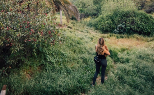
But as I acclimated to LA’s perfect weather, suddenly prone to complaining if it dipped below 60 degrees, I also fell in love with the wilder side of the sprawling metropolis. Believe it or not, Los Angeles has nature everywhere and you can access it easily, year round. I didn’t need to road trip to a National Park for a day, I could walk out my front door and, in minutes, be hiking up a mountain. Desert, mountains, cliffs, beaches, forests — they were all at my fingertips.
I soon grew obsessed with hiking. Living at the base of Runyon Canyon, I began to hike into the hills every day. I became the sort of person who suggested a hike and a boba tea to friends rather than another happy hour. On weekends, I hit up spots a little further afield — though usually never more than an hour away. That’s when I discovered the magic of Los Angeles. While many cities offer micro adventures perfect for 24 hours or a weekend, L.A. has scores of micro micro adventures. All it takes is a few hours to connect to the natural world and feel like you’ve re-centered yourself.
I’ve taken dozens of hikes in the region over the past several years. They’re all great in their own ways (is there such a thing as a bad hike?) but these are a few of my favorites.
Los Liones Trail To Parker Mesa Overlook
This is my favorite trail in Los Angeles, hands down. I hate to break into my Stefon from SNL voice, but this trail truly has everything: stunning ocean views, a foresty feel, desert landscapes, different levels of difficulty and models jogging on the weekends.
The first half of the hike is uphill but can be done at a leisurely pace. Depending on the season, you’ll pass various plants and wildflowers. There are plenty of trees to provide cover and you end with a beautiful view, overlooking the ocean. This is the easy portion — you can bring pretty much anyone at any skill level, and they’ll feel both satisfied by the workout and awed by the beauty of the trail. If you continue on, you’ll be gifted another kind of satisfaction. The going gets steeper and the sun beats down on you, snakes might cross your path, you begin to ration your water, and then, just when you think you can’t go any further, you’re rewarded with truly insane views all around you — the kind that legit make you a little teary-eyed.
By the end, you’re out of breath and you feel this sense of genuine accomplishment. How did I get lucky enough to live here? You’ll ask yourself, as any stress from city life melts away.
Want to go there?
Trailhead: Sunset Blvd and Los Liones (The trailhead is at the end of Los Liones).
Roundtrip distance: About 3 miles to the first lookout, 6.5 miles if you continue to Parker Mesa Overlook.
After the hike: Head to Malibu Seafood on PCH and eat fresh fish right on the beach.
Sturtevant Falls
Located in the San Gabriel Mountains, the Sturtevant Falls hike feels like you’re skipping out of Southern California and venturing into wholly different landscapes. The cliffside drive to the starting point is far more reminiscent of the mountains in Montana or Idaho. Then the green, misty feel of the hike gives you Pacific Northwest vibes. You definitely feel like you’ve stepped out of California and, as you hike, out of time as well — passing dozens of unique, little cabins built at the turn of the 20th century, the oldest in 1898, still preserved and only accessible by foot.
As you cross gurgling creeks and pass wooden signposts, you get the sense that you have gone back to a simpler era. The falls themselves are lovely, as waterfalls always are. This is that rare sort of hike about which I cannot say whether the “walk to” or the “payoff upon arrival” is better. They’re both too spectacular to compare.
Fun fact: I filmed one of those, “I almost died in the woods reenactment” shows in this forest years ago. I’ve never seen it, but it was about a woman trapped under a boulder. I was “friend hiking” if you ever happen to catch it on reruns, though taking the hike for yourself is much more rewarding.
Want to go there?
Trailhead: Enter Angeles National Forest through Chantry Flats Rd and drive until you reach the Chantry Flats Recreation Area parking lot (a pass is required to park and can be purchased at the park store).
Roundtrip distance: About 3.25 miles.
After the hike: Head out of the San Gabriel Mountains and into the San Gabriel Valley where you’ll find an insane amount of amazing dumpling restaurants. If you want our pick, you can’t go wrong with the soup dumpling at Din Tai Fung. Unless it’s wrong to eat soup dumpling after soup dumpling until you pass out. If that’s the case, we don’t want to be right.
Hike to the Hollywood Sign
I love this challenging hike to the Hollywood sign in Griffith Park. First, let me note that Griffith Park, in general, is a Los Angeles treasure. It’s beautiful, wild, gigantic, and was originally owned by a guy named Griffith J. Griffith, who did eventually try to murder his wife, but with a name like that…it kind of tracks that he was destined for something awful.
Anyway, there are tons of hikes and experiences to have in Griffith Park that involve little to no murder. Like reaching the iconic Hollywood sign by foot. This hike is hot, with little cover, so make sure to bring plenty of water and sunscreen. That said, it’s also totally doable and “medium” — in terms of difficulty. On this route, you can make a pit stop at the Bronson Caves — which is where the original Batman tv show was filmed, a show I have never seen, not even a clip of. And yet, every time I bring someone here I walk them to the caves.
“The original Batman tv show was filmed here,” I say.
“Oh,” they say, also having never seen the show, as we were both born 20-30 years after its run. “That’s interesting.”
It is, I guess. But not as interesting as the beautiful views you get of the city before ending up behind the sign itself. You can’t touch the sign, as much as you want to — there’s a fence. No standing in the “O” and screaming, “OHHHHHHH, Hollywooooood!” Or whatever better thing you were going to yell. It’s still really cool to stand behind the massive letters, which have served as a beacon to wide-eyed ingenues for nearly a hundred years. And once you’ve traversed and conquered this trail by foot, you can also try it by horse. Warning though: horses are not particularly impressed by the Batman caves and the sign.
Want to go there?
Trailhead: Enter into your GPS, “3200 Canyon Dr, Bronson Canyon Griffith Park, Los Angeles, CA.
Roundtrip distance: 6-7 miles.
After the hike: Hit up delicious Alcove Cafe in Los Feliz for brunch on the patio and some lowkey celeb sightings.
Escondido Falls
https://www.instagram.com/p/BvZmp6Ag89o/
This is one of the first hikes I did moving to LA, and while it was a solid start for a Midwesterner who didn’t know better, it’s continued to impress me over the years. Fields of wildflowers, gentle streams to cross, waterfalls at the end, it has plenty of variety, and it’s easy enough for anyone to tackle. You do have to go over some boulders and, if you want to get to the upper falls, you have to go up a steep incline, but there’s a rope to help you along. Do I find the rope part scary? Sure. But I also find riding a bike slowly on a flat sidewalk scary, so I may not be the best judge.
Just make sure you have good hiking shoes, and again, water. Who goes on a hike with no water?
Want to go there?
Trailhead: PCH and Winding Falls Rd (You’ll have to walk through a private neighborhood to reach the actual trail).
Roundtrip distance: 3.7 miles.
After the hike: Head to Duke’s for fish tacos, drinks, and an amazing view of the ocean.
Westridge Trail To the Nike Missile Site
Look, waterfalls are nice. Nobody is saying they aren’t nice. But every hike can’t be a waterfall hike. Some hikes are inevitably going to arrive at the ruins of a cold war era nuclear missile defense site. I don’t make the rules. That’s just life. The yin and yang.
That said, while this doesn’t sound like an awesome hike, it absolutely is. It’s right above the Brentwood neighborhood, but it feels like it’s a million miles away from the city. It’s a long trail, wide, and stunning — with an open feeling that strips away any of the tension of city confines. There are gorgeous views and lovely plant life. And at the end, it is interesting to read the plaques and check out the old missile defense bunkers. I like to imagine that I’m in a post-apocalyptic world and this is where I live, venturing out into the world only for supplies and to battle zombies.
Warning, this hike does get very hot and you will get very thirsty. Bring. Water.
Want to go there?
Trailhead: Mandeville Canyon Road and Westridge Road. Trailhead is at the end of Westridge.
Roundtrip distance: 4.5-7.5 miles roundtrip, depending on the route.
After the hike: Quench your thirst at the Brentwood location of Lemonade with a glass of the sweet stuff as well as tons of healthy a la carte veggies and meats.
Paradise Falls
I did this hike, just outside of Thousand Oaks, for the first time only recently, but it’s dreamy, and immediately went on my “favorites” list. Snaking downhill on switchbacks and stairs, losing elevation fast, to make it to an insanely impressive falls makes this a unique hike that I absolutely loved. The only downside? The payoff is at the bottom of the canyon, so getting there is the easy part and it’s all uphill on the way out.
Still, the waterfall is so stunning, it’s worth it.
Want to go there?
Trailhead: Head to the Wildwood park parking lot in Thousand Oaks. The Mesa Trailhead is obvious from there.
Roundtrip distance: 2.15 miles.
After the hike: Bring a picnic lunch and sit at a picnic table just outside the falls, you just went all the way downhill, you’ll need the fuel to go back up.
The Griffith Observatory Hike
https://www.instagram.com/p/BJ6Pl4ED7lo/
As I said before, Griffith Park is wonderful. Enough to merit two spots on this list.
The park’s crowning jewel is the gorgeous observatory at the top — with its 360-degree views of the city, beautiful architecture, museum/planetarium, and claim to fame as a place both James Deans have filmed at (the first is regular James Dean, the second, obviously is modern day James Dean, Ryan Gosling).
I love that this hike feels like a multi-layered experience. There’s no “okay, let’s have a sip of water and head back down again, I guess?” here. It’s pretty easy, you gain elevation fast from the bottom of Griffith Park, but it’s over quickly, and then you get to explore the observatory in all its glory. There are amazing photo opportunities here from the Hollywood sign, to downtown, to the ocean in the background. I also love walking around the inside of the free observatory. It’s beautiful and there are some cool, little exhibits to check out.
Want to go there?
Trailhead: Turn north onto Ferndell Drive off of Franklin and park wherever along the road. There’s a trail that goes to the other trail — it’s just a lovely, flat stroll. On the way, you can stop at Trails Café for a snack to bring on your journey.
Roundtrip distance: About 2 miles.
After the hike: Head to Bar Covell for some light bites and well-curated drink experience.
Runyon Canyon
https://www.instagram.com/p/BwPtuyKh8Oc/
Look, I get that Runyon is a cliché. A place crowded with random celebrities and tourists and Instagram influencers working out in crop tops. But here’s the thing: I’ve done this hike maybe 200 times, if not more, and I have to say, there has never been a time where I got to the top, looked from the ocean across to Hollywood, to downtown, to Griffith Observatory, that I didn’t think, “Damn, it’s amazing that I get to live here.”
This hike, perhaps more than any other, gives you the scope of how vastly diverse the city is. It’s truly part of the DNA of Los Angeles and a key to understanding the city itself.
At some point, Runyon became this point of mediation every day for me. I’d wake up and struggle up the hill to the trailhead, then walk the hardest route, step after step. As I hiked, my mind would start to turn off and my anxieties would fade away as I concentrated on making it to the top. I think, in some ways, Runyon is the perfect example of living and working in L.A. You may be in the midst of masses of people and dogs and cityscape and random hot people running ahead of you. But at the end of the day, it’s just you. Going at your own pace. Your accomplishments are yours and yours alone.
At the top of Runyon Canyon, my personal habit is to draw long, slow breaths, down my water, and think, “I can kind of can do anything, I’m a badass.” Try it. You’re sure to be at peace, right smack dab in Hollywood. That kind of feeling, in one of the biggest cities in the country, is incredible and all too rare.
Want to go there?
Trailhead: Reach the Park entrance from either Vista or Fuller streets where they end. Note: Parking is permitted on weekends so be careful of signs. I usually find parking on Gardner, just south of Hollywood Blvd, and walk up Vista Street.
The walk up is a bit steep from the car and by the time you get to the trailhead, you will be regretting all your life decisions, but it’s worth it. I promise.
Roundtrip distance: 1-3 miles, depending on the trail.
After the hike: Hit up nearby El Compadre for delicious Mexican food and flaming drinks, or The Pikey down the street — which serves up amazing comfort food and cocktails in a cozy, British-inspired pub.