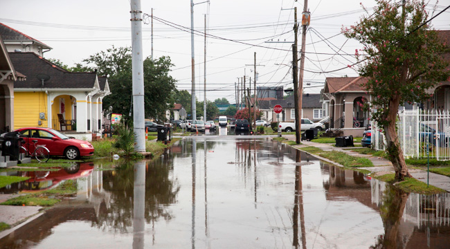
Earlier this week, New Orleans streets saw flash flooding ahead of a forecast tropical storm formation in the Gulf of Mexico. That system has now developed into Tropical Storm Barry, and Louisiana has declared a state of emergency with meteorologists warning that Barry could strike New Orleans and nearby parts of the Gulf Coast as a Category 1 hurricane with winds in excess of 75 mph. The system is projected to make landfall late Friday or early Saturday, and here’s Weather Nation’s current satellite image.
BREAKING: Tropical storm #Barry has formed in the Gulf of Mexico. Previously called Potential Tropical Cyclone 2, major impacts are still expected to the Gulf Coast
Story: https://t.co/leMPDyrPbl pic.twitter.com/Sx5naBLQrt
— WeatherNation (@WeatherNation) July 11, 2019
The National Weather Service office in New Orleans is warning that water will continue to be “the biggest threat” during the storm with flash flood warnings extending from NOLA and Baton Rouge to parts of Mississippi, and Houston’s also on alert. Via CNN, New Orleans Mayor LaToya Cantrell has warned of possible “heavy rainfall for up to 48 hours.” At this time, the city hasn’t issued evacuation orders, but Cantrell has asked people to make just-in-case plans, and even though the city’s pumps are currently operable, the huge amount of expected rainfall may still render the situation dire:
“We cannot pump our way out of the water levels and the waterfalls that are expected to hit the city of New Orleans. We need you to understand this and again, be prepared to shelter in place.”
Store shelves are already going empty, as this photo from Cheryl Gilmore in Opelousas, Louisiana shows.
Meteorologist James Spann has tweeted a satellite projection of what’s to come for Barry during the next few days.
Visible satellite view of what will become Tropical Storm Barry in coming days. pic.twitter.com/HehI7wkSF2
— James Spann (@spann) July 10, 2019
(Via Weather Nation, NPR, Weather.gov & CNN)
