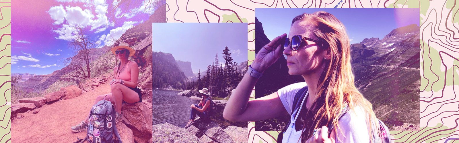
Edward Abbey famously said, “A man on foot, on horseback or on a bicycle will see more, feel more, enjoy more in one mile than the motorized tourists can in a hundred miles.” At Uproxx, we have to agree.
By now we all know about the very real physical and mental benefits of nature, but there is nothing quite like getting out into nature on a hiking trail. Being surrounded by forest, desert, mountains, meadows, or water without the constant stream of notifications from our daily lives is purifying in its simplicity and remarkable in its results.
Whether inspired by social media, awareness of health benefits, more flexible schedules of the last few years, or just a desire to take a technology break, there’s no denying that hiking is booming in popularity across the United States. From 2019 to 2020 alone, the percentage of logged hikes on AllTrails was up over 170%. National Parks have seen increased visitation leading to timed entry systems and vehicle reservations, while sales of outdoor gear have steadily increased.
If you’re like many travelers this year, hiking is an activity you want to incorporate into your travels. Here are some of our favorites:
1. THE BEEHIVE LOOP – Acadia National Park – MAINE
WHY IT’S AWESOME:
Acadia is a crown jewel of the National Park system. The legendary park in coastal Maine is consistently in the top 10 most visited major National Parks with over four million visitors in 2021. Acadia is also one of the smallest major parks by land area, encompassing just over 49,000 acres over the most visited Mount Desert Island, part of the less visited Schoodic Peninsula, part of the Isle au Haut as well as 16 other outlying islands. So while this may not be the first park you’d think of for difficult hiking trails – it has its share.
Clocking in at just 1.5 miles – The Beehive Loop is definitely one of Acadia’s best. It’s the shortest trail on this list, but also rated as difficult. While not as deathly (really) as the Precipice Trail in the park, The Beehive is a short but challenging hike with a big payoff.
TRAIL NOTES:
The trail begins across the street from the Sand Beach Parking Lot. The trail begins on the Bowl Trail then splits – you’ll go right for the loop that takes you on the Beehive Trail up to the Beehive Summit and down the Bowl Trail. There are sections of climbing on the Beehive Trail where you will use iron rungs to help scramble and climb up to the top – with panoramic views of the gorgeous Maine coast.
TOTAL DISTANCE: 1.5 miles
ELEVATION GAIN: 450 ft
DIFFICULTY: Hard – Not recommended for small children or those with a fear of heights
BEST TIME TO HIKE:
Summer and fall in Acadia are bucket-list, but you’ll also be met with crowds. I wouldn’t recommend hiking this one in the winter with any snow or ice on the trail, or after rain. The steep drop offs and exposure are no joke.
WHERE TO GRAB A DRINK AFTER:
Head back to Bar Harbor and grab a refreshing local beer at Atlantic Brewing Company.
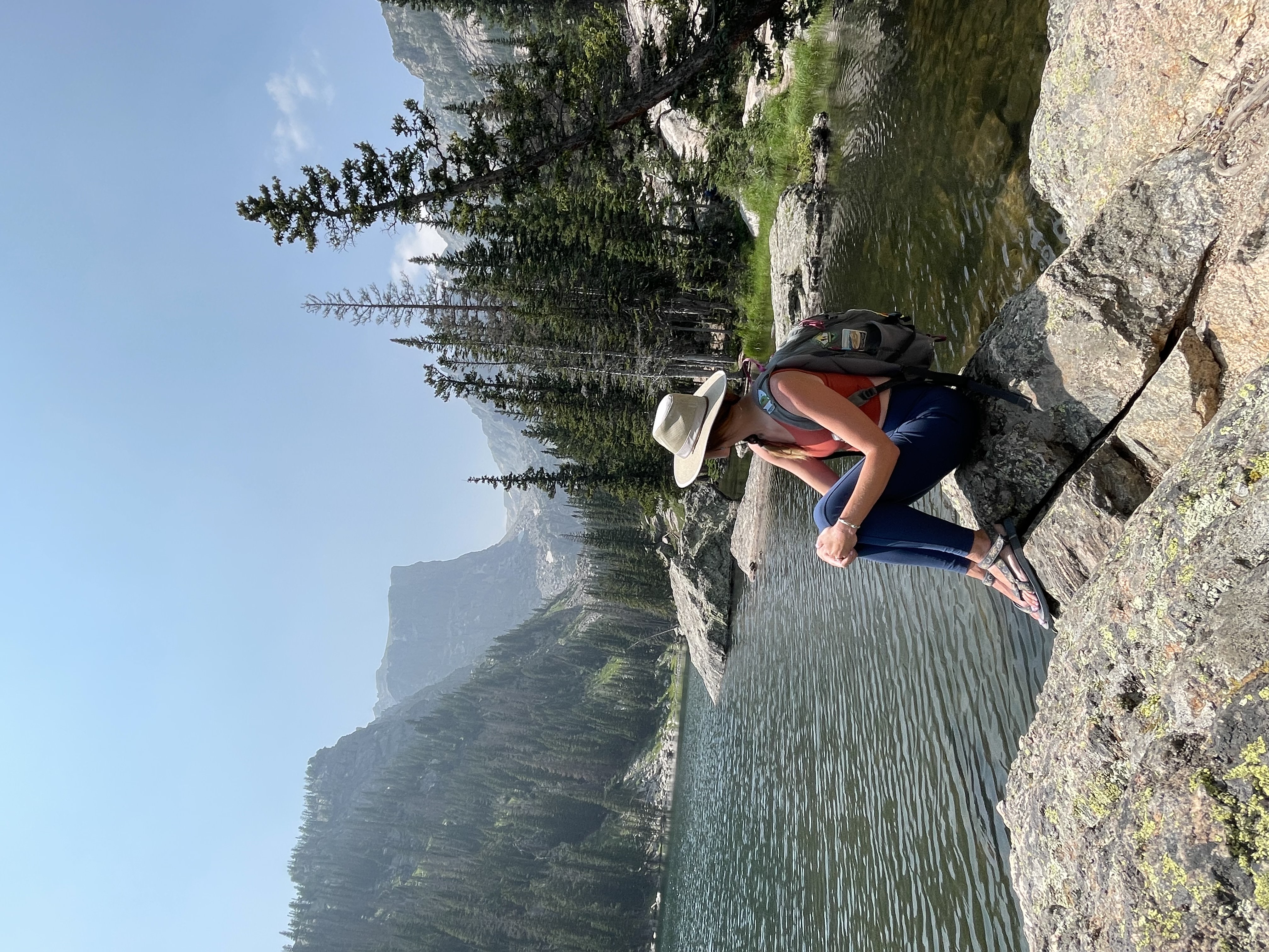
2. EMERALD LAKE TRAIL – Rocky Mountain National Park – COLORADO
WHY IT’S AWESOME:
Rocky Mountain National Park is a bucket list destination for all levels of outdoor enthusiasts. With over 355 miles of trails in the park – it’s a hiker’s dream. But if I could only choose one hike to take in the park, I’d answer like most people would (it’s popular for a reason y’all) and I’d hike Emerald Lake Trail. It truly has more “bang for your buck” than any other trail on this list, heck – probably any trail I’ve ever hiked.
Clocking in at just 3.2 miles, you’ll hike into a quintessentially Colorado mountain landscape that is jaw-dropping at every turn. Starting at one gorgeous lake and passing by two others on the way to your postcard-perfect destination – it’s probably going to be crowded, but it’s going to be worth it.
TRAIL NOTES:
As mentioned, one of the amazing perks of this trial is its accessibility. Emerald Lakes Trail begins at Bear Lake – which you can easily whip around to add another 0.7 miles to your hike and is totally accessible. From there you’ll hit the Emerald Lake Trail itself which is to the left when you enter into the Bear Lake Trail area from the parking lot. Then you begin to slightly climb up 0.5 miles to Nymph Lake – one of my favorite lakes in the Rockies, and a perfect place to catch your breath if you’re not yet used to the elevation (9,710 ft). From there you’ll climb a bit higher another 0.6 miles or so to the Instagram star – Dream Lake. This is a perfect place to stop for a snack and admire the view. From there you will hike up another 0.7 miles or so – and pass a waterfall – until you reach Emerald Lake.
TOTAL DISTANCE: 3.2 miles
ELEVATION GAIN: 698 ft.
DIFFICULTY: Easy.
BEST TIME TO HIKE:
This is a popular spot all year round (try snowshoeing!) so you’ll need to be prepared to take the park service shuttle if parking is full. Between May 26 and October 22 you’ll also need a timed entry reservation to access the Bear Lake Corridor and the trailhead. These can be reserved here.
WHERE TO GRAB A DRINK AFTER:
Head into Estes Park and visit my favorite spot – Snowy Peaks Winery.
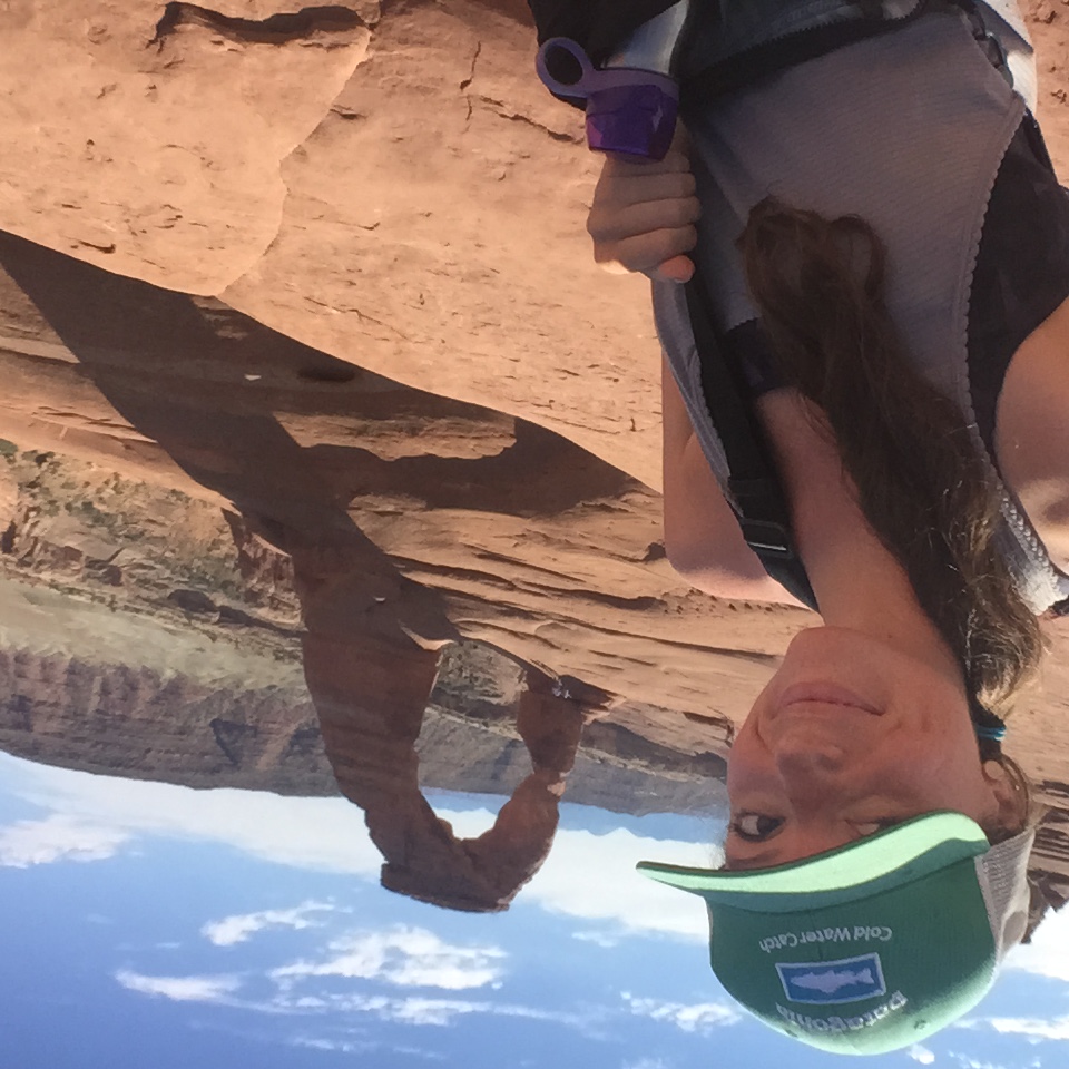
3. DELICATE ARCH – Arches National Park – UTAH
WHY IT’S AWESOME:
If you’ve ever seen a photo of a hike in Utah, it’s likely of Delicate Arch. The iconic natural rock formation that graces the state’s license plates (and pretty much every other Utah-branded item) is legendary for a reason. With over 2,000 documented arches in Arches National Park, this is by far the most well-known, as well as holding the title of largest free-standing arch in the park, with an opening beneath the arch of 46 ft tall by 32 ft wide and an entire rock span reaching 60 ft.
TRAIL NOTES:
This hike, while only 3.2 miles round-trip, can be deceptively strenuous. You’ll be climbing up steep slickrock with virtually no shade on the entire trail, with the National Park Service noting that rangers often have to rescue visitors who underestimate the trail’s difficulty. But if you’re prepared – it’s an incredible sight to see up close.
You’ll start by parking at the Wolfe Ranch lot – which is likely to fill most days. Another option is to begin at the Delicate Arch Viewpoint parking lot – which adds 1 mile each way to the hike. The trail begins with some steep climbing on slickrock until it eventually levels to a more manageable slope. The trail is marked with cairns until you reach a 200-yard rock ledge that may be difficult for someone with a fear of heights. After the ledge, the arch will come into view where you can choose to walk over for photos or sit and admire the view.
TOTAL DISTANCE: 3.2 miles
ELEVATION GAIN: 629 ft.
DIFFICULTY: Moderate.
BEST TIME TO HIKE:
There is almost no shade on this trail, so midday hiking in summer is discouraged. Summer is also going to be extremely crowded. Spring and fall are your best bet, while winter is doable if you’re prepared with the correct equipment for possible snow and ice. Be aware you’ll need a timed entry ticket to access any part of Arches National Park from April 1 to October 31.
WHERE TO GRAB A DRINK AFTER:
Moab is just outside the park and chock full of bars and restaurants. I recommend stopping by Moab Brewery or Thai Bella Moab.
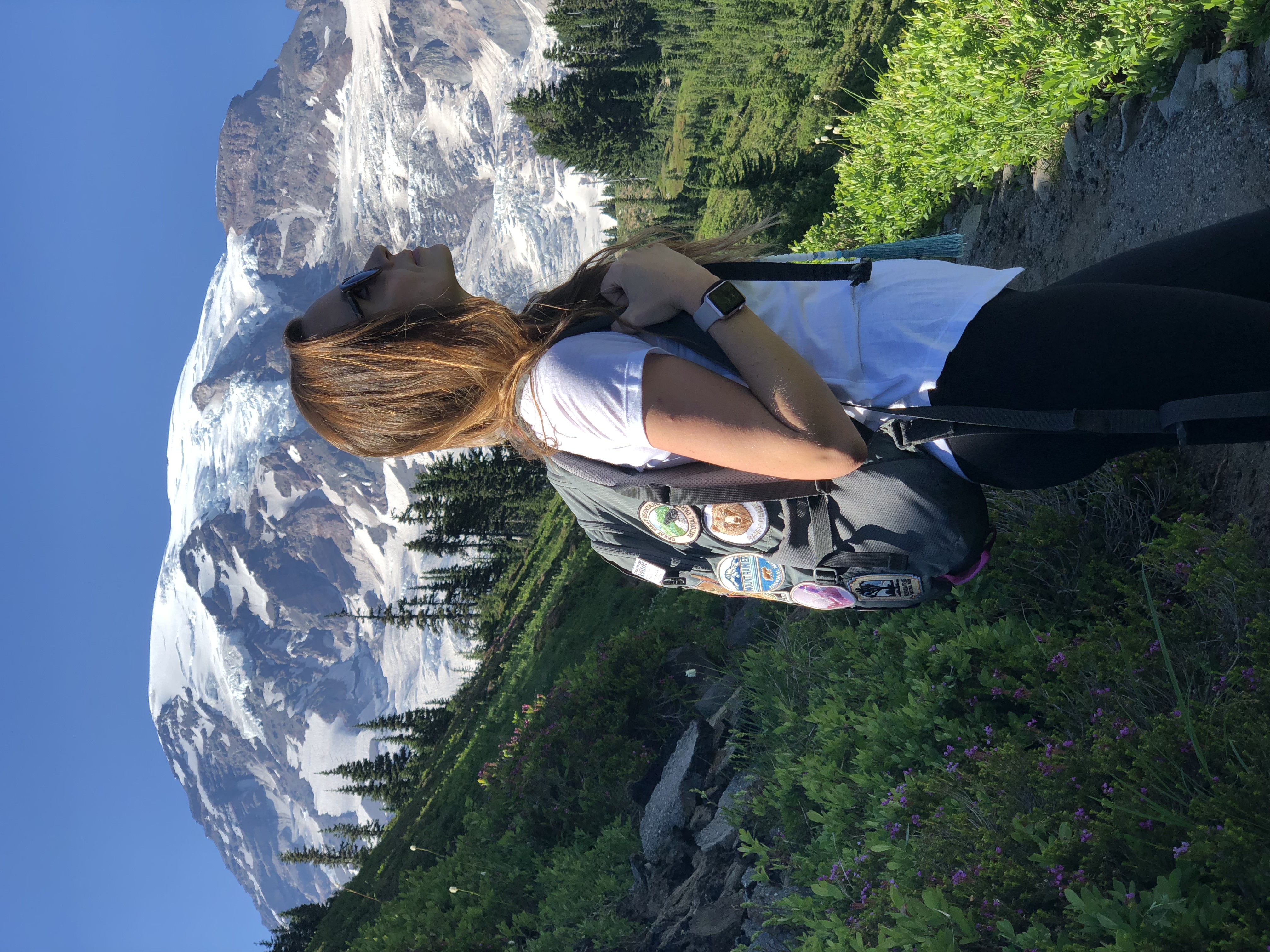
4. SKYLINE TRAIL LOOP – Mount Rainier National Park – WASHINGTON
WHY IT’S AWESOME:
Mount Rainier is not just impressive – it’s imposingly so. To catch a glimpse of the 14,410 ft active volcano is truly a moment where the veil between heaven and earth is at its thinnest. There are plenty of incredible hiking trails in the over 236,000 acre park, but if I had to choose just one, it would undoubtedly be Skyline Trail Loop. The trail begins at the popular Paradise parking area and lives up to its name – and then some.
TRAIL NOTES:
You’ll start your hike in the Paradise Valley from the Paradise parking lot after a gorgeous drive through the park. There are many trails in this area, so you’ll want to pick up a map or have one downloaded. After some time hiking on pavement, you’ll come to a fork and need to decide if you’ll take on the trail clockwise or counterclockwise. Counterclockwise has slightly less elevation gain on the climb up to Panorama Point, but both have the same amazing views.
If you hike clockwise, you’ll hike up the steep trail to Panorama Point, continues along to Stevens-Van Trump Memorial, descend into Paradise Valley, a slight climb to Myrtle Falls then back to where you began.
TOTAL DISTANCE: 5.5 miles
ELEVATION GAIN: 1,700 ft.
DIFFICULTY: Hard.
BEST TIME TO HIKE:
Mount Rainier is known for wildflowers – and mid to late August is going to be prime time – although July and August are both great times to catch wildflowers and waterfalls. Summer, of course, will be more crowded so start your hike as early as possible. You can hike in the winter, just be prepared with poles, spikes and other winter hiking equipment.
WHERE TO GRAB A DRINK AFTER:
I always like to stop at the Longmire Inn, which is a National Park Inn within the park for a drink or a snack.
5. HIGHLINE TRAIL TO GRANITE PARK CHALET — Glacier National Park – MONTANA
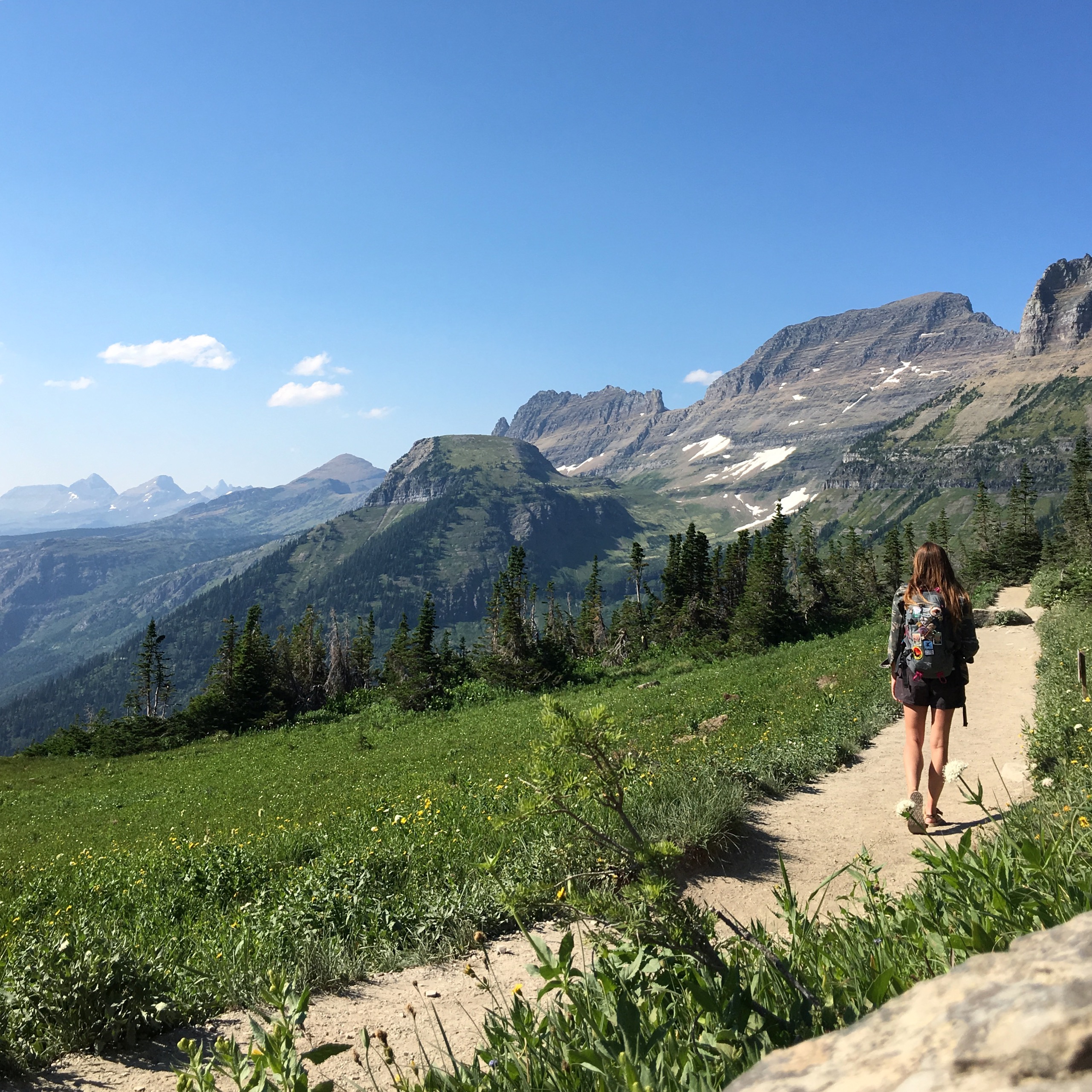
WHY IT’S AWESOME:
Glacier National Park is a major bucket list park for all kinds of outdoor enthusiasts – particularly hikers. With over 700 miles of hiking trails over a remarkable 1 million acres of land – the options are endless. With so much land to cover between the seven separate entrances of the park, it can be overwhelming to plan a hiking trip. Highline Trail offers incredible views, but is also right off Going-To-The-Sun Road – the nearly 50 mile road that is registered as a National Historic Landmark, Historic Civil Engineering Landmark and National Historic Place. The road is spectacular and the trail is even better.
TRAIL NOTES:
The trail begins on the Continental Divide, just across from the Logan Pass Visitor Center on Going-To-The-Sun Road. The first 3 miles are fairly level albeit exposed and possibly terrifying once you reach an infamous ledge with hundred-foot drop-offs at around just one-quarter of a mile into the hike. There is a cable to hold onto during this fairly short portion of the hike. Then you’ll have a challenging hike ahead through mostly the Garden Wall portion of Glacier following the Continental Divide through meadows, with incredible views all around.
Although the Highline Trail in its entirety is nearly 24 miles round trip, many people hike the trail to Granite Park Chalet before turning back around. The chalet is only accessible by hiking or on horseback and does accommodate overnight guests – although all rooms are sold out for the 2023 season.
TOTAL DISTANCE: 14.9 miles
ELEVATION GAIN: 2,578
DIFFICULTY: Hard.
BEST TIME TO HIKE:
The best time to hike is between July through September. You have to drive on Going-To-The-Sun Road to reach the trailhead, which generally does not open for the season due to snow until late June and closes again in October. You’ll need to secure a vehicle registration to access the road and four other areas in Glacier between May 26 and September 10 if entering on the West side and from July 1 through September 10 if entering from St. Mary’s.
WHERE TO GRAB A DRINK AFTER:
I love to head down to Lake McDonald Lodge to grab a drink with a view at Lucke’s Lounge.
6. THE NARROWS – Zion National Park – UTAH
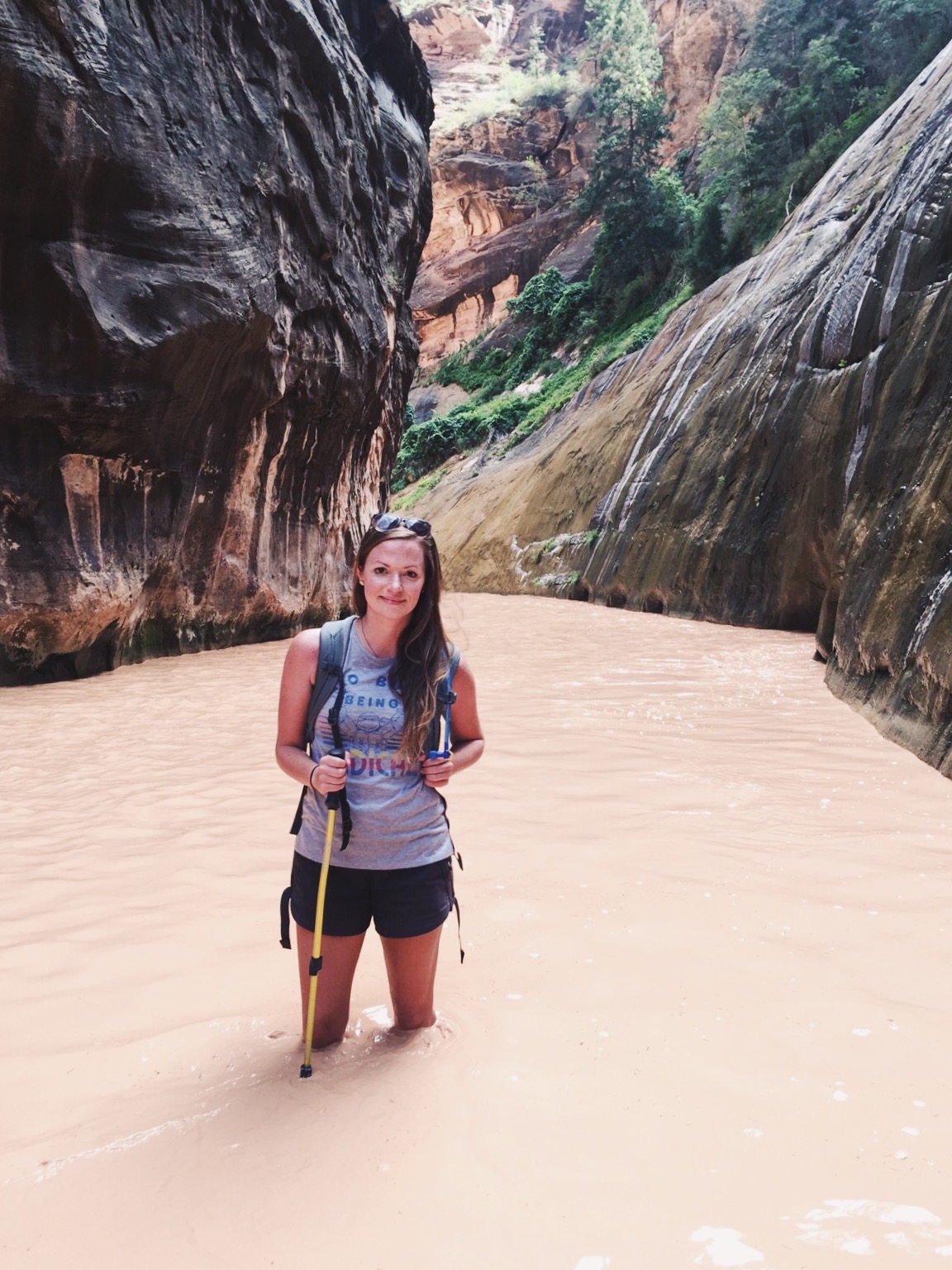
WHY IT’S AWESOME:
Zion National Park has exploded in popularity in the last decade with visitation since 2010 nearly doubling – securing the park the title of second most visited major park in the National Park System. With over 20 hikes within Zion, including the social media famous Angel’s Landing, it can be tough to decide which to hike on a short visit. While the landscape is unique and awe-inspiring throughout the park, I think the most unique trail that doesn’t require a permit is hands down The Narrows.
The hike will take you directly through the Virgin River, with over 60% of the hike requiring wading, hiking, and even swimming in the river itself with the incredible canyon walls surrounding you. You can hike The Narrows Bottom Up or Top Down – but Top Down requires a permit – so for this and other reasons most people choose Bottom Up.
TRAIL NOTES:
The trail, as mentioned, is mostly within the Virgin River with most people beginning at the Temple of Sinawava via the Riverside Walk and then walking upstream through the river before turning around – many hikers turn at Orderville Canyon or continue on to Big Springs but you can whenever you feel like it. There is no specific vista or summit to see – it’s all incredible. I would recommend hiking at least the section known as “Wall Street” which is just over three miles into the hike.
Because of the nature of this trail, you’ll need special equipment. Hiking poles, closed-toed shoes, neoprene socks, and a dry bag are all musts, and specialized gear can be rented from many outfitters in Springdale.
TOTAL DISTANCE: 8.9 out and back to Big Springs. 16 miles for the entire hike (with a permit)
ELEVATION GAIN: 695 ft.
DIFFICULTY: Hard
BEST TIME TO HIKE:
Due to temperature, summer and early fall is definitely the best time to hike The Narrows. This is also the season for thunderstorms though and can lead to potentially life-threatening flash flooding. Winter and spring are much colder and less crowded – you’ll need a full-body wetsuit if you’re hiking during this time. The Narrows is also often closed for periods when the snow melt raises the river to over 150 cubic feet per second or when a flash flood watch is enacted. You’ll want to start your hike as early as possible to escape the crowds you’ll find on your way back.
WHERE TO GRAB A DRINK AFTER:
Head into Springdale and grab a beer at Zion Canyon Brew Pub.
7. BRIGHT ANGEL TRAIL TO PLATEAU POINT– Grand Canyon National Park – ARIZONA
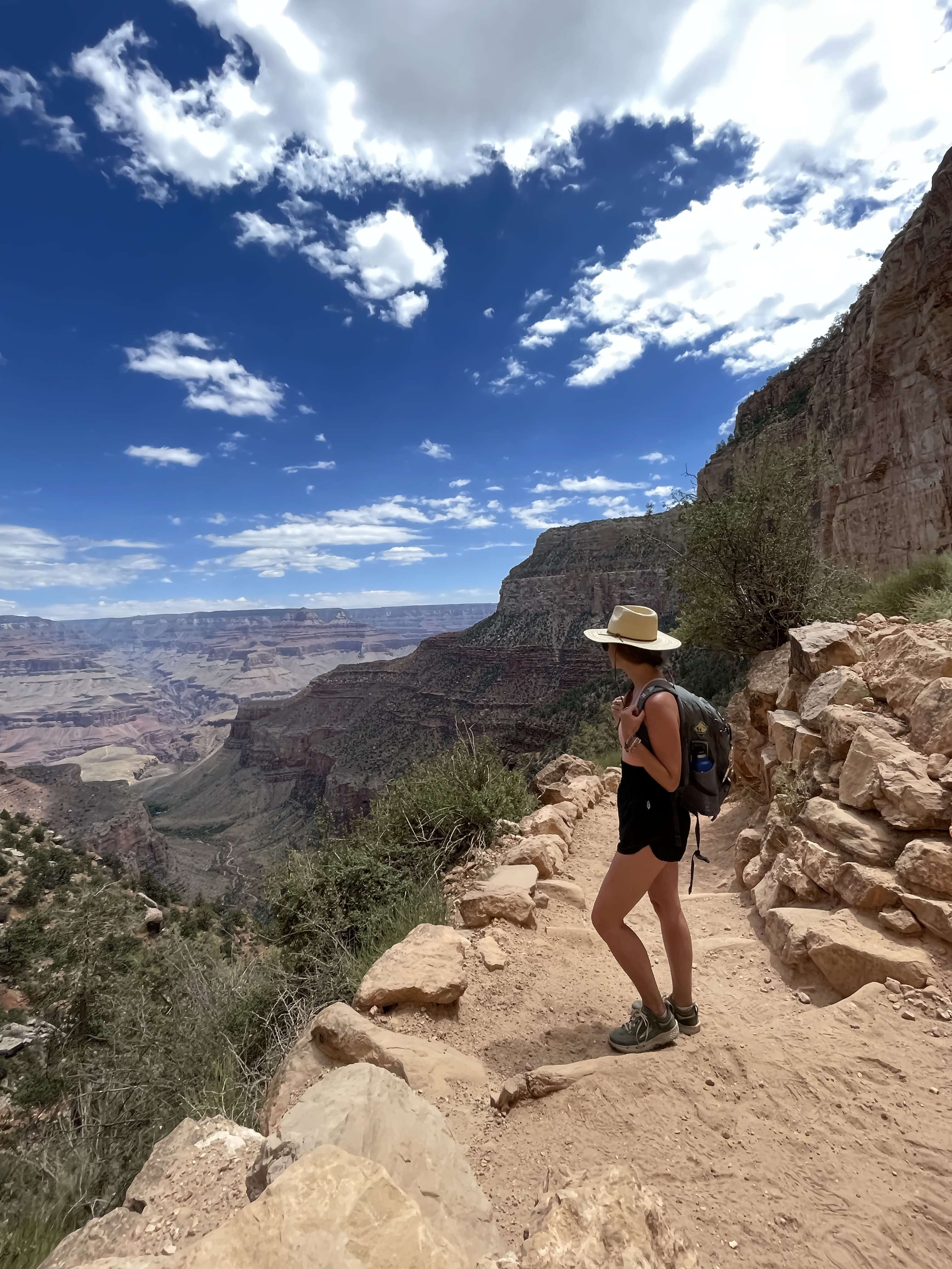
WHY IT’S AWESOME:
The Grand Canyon, considered one of the Seven Wonders of the World, is likely on most travelers’ must-visit lists. But despite its popularity, many people who visit don’t actually hike very far into the canyon itself. The 278-mile-long canyon is up to 18 miles wide and over a mile deep, with some of the most incredible views and vistas one can ever witness with their own eyes. But hiking down into a canyon means you’ll have to hike back up later, which can be extremely strenuous for even an experienced hiker.
There are over 100 trails in the park according to AllTrails, but one of the most popular – for good reason – is Bright Angel. This trail gets you below the rim for as short or long of a jaunt as you’d like.
TRAIL NOTES:
Bright Angel Trail starts off directly in the Village at the South Rim just west of Bright Angel Lodge. You’ll begin the descent into the canyon immediately and cross under the first tunnel at just shy of 0.2 miles. You’ll enter a period after the second tunnel (0.75 miles) of steep switchbacks and then will pass a water and rest station at 1.5 miles. There is another water and rest stop at 3 miles and water is available again at Indian Gardens which is at mile 4.5.
In the summer, this is where you’ll need to turn around if you have not already – getting back up can take at least twice as long and once you’re in the canyon it can be difficult to understand how far you’ve gone. In other seasons you can continue on to Plateau Point at mile six.
TOTAL DISTANCE: 12 miles
ELEVATION GAIN: 3,080 ft.
DIFFICULTY: Hard
BEST TIME TO HIKE:
Fall and spring are going to be best for hiking this trail, as summer temps can become dangerous. If hiking in the summer, the National Park Service recommends avoiding the trail between 10am and 4pm and it is not recommended to hike rim to river in one day during this time for this reason. In winter and early spring the upper portions of the trail can be extremely icy.
WHERE TO GRAB A DRINK AFTER: I love to walk the short distance on the South Rim to the classic El Tovar Hotel Lounge to get a drink on the veranda.
8. APPALACHIAN TRAIL – SPANS 14 STATES
WHY IT’S AWESOME:
While not exactly a day hike – or even weeks for that matter – hiking the Appalachian Trail should be on everyone’s list. At least a portion of it, that is. While the entire trail from Georgia to Maine is nearly 2,200 miles and spans over 14 states, that also means portions are easily accessible to the average hiker who doesn’t have five to seven months to complete it. Whether you’re in Georgia, North Carolina, Tennessee, Virginia, West Virginia, Maryland, Pennsylvania, New Jersey, New York, Connecticut, Massachusetts, Vermont, New Hampshire, or Maine – look for the AT signage while hiking – I’ve hiked on portions of the trail several times without realizing until I was already there.
And you never know, it might just inspire a thru-hike in the future.
TRAIL NOTES:
It would be impossible to explain a trail that is over 2,000 miles, but I can recommend a great way to experience the trail as a beginner – through portions in and near Shenandoah National Park and Blue Ridge Parkway in Virginia. There are 104 miles of the trail in Shenandoah National Park, with elevation gains that generally stay below 1,000 ft. The trail is well maintained and portions are a great option for a day hike.
TOTAL DISTANCE: 2,190 miles
ELEVATION GAIN: 453,750 ft
DIFFICULTY: Hard.
BEST TIME TO HIKE:
Weather is of course going to fluctuate depending on where you’re hiking, so be prepared to do your research and bring anything you’ll need. Late spring and early fall are generally going to be your best bet for a day hike. Thru-hikers generally start in March or April in Georgia, ending around September in Maine.
WHERE TO GRAB A DRINK AFTER:
Hit up a bar or restaurant in one of the over 40 trail communities – towns near the trail that have qualified under the Appalachian Trail Conservatory’s A.T. community program.


